
Overview
Simplify unit conversion in CAD drawings using SPCAD’s Change Units tool. Whether you’re converting meters to feet or between any supported unit, SPCAD handles the scaling automatically, retaining full precision, geometry alignment, annotations, and dimensions.
This is particularly helpful for civil engineers, urban planners, and CAD professionals working across different unit systems.
You can view full documentation here: Change Drawing Units
Why Unit Conversion Matters in CAD
Sometimes, CAD users receive project data in one unit system but must continue work in another. For example, a survey might be prepared in meters, while the planning team requires feet for further development.
Traditionally, CAD offers two manual methods:
- Creating a New Drawing:
Open a new drawing, set its units to feet, and copy-paste your geometry from the original file. The pasted data adjusts automatically, but this can cause alignment or scale mismatches if not done carefully. - Manual Scaling:
Alternatively, users can manually reposition and scale drawings using conversion factors (e.g., multiplying by 3.28084 to convert meters to feet). While effective, this approach requires time and precision.
Both methods work, but they involve manual effort, calculations, and a risk of human error.
SPCAD’s “Change Units” Tool: A Smarter Way
SPCAD simplifies drawing unit conversion in CAD with its built-in Change Units command. With just a few clicks, you can:
- Convert from meters to feet, feet to meters, or between any supported units.
- Automatically adjust coordinates, text, blocks, and dimensions.
- Maintain the original precision and scale of your drawing.
- Eliminate the need for manual re-scaling or redrawing.
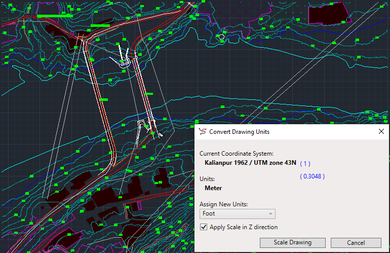
The process is fully automated, ensuring accuracy and speed — ideal for multidisciplinary teams sharing CAD files across regions.
Example Use Case
Imagine receiving a topographic survey in meters, but your project specifications require feet. Simply launch SPCAD’s Change Units tool, select the target unit, and watch the drawing update instantly. No coordinate shifts. No scaling errors. Just clean, consistent precision.