Overview
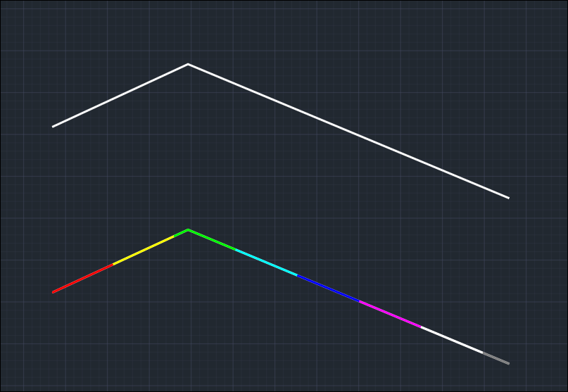
The Break by Distance tool allows users to divide a polyline into smaller equal-length segments based on a specified break distance. This is especially helpful when working with linear features such as roads, pipelines, or contours that need to be subdivided for analysis, annotation, or modeling.
This tool automates the segmentation process instead of manually trimming or measuring, resulting in a clean, consistent series of polylines.
Use Cases & Utility
- Survey Stationing: Divide alignments at regular intervals (e.g., every 100 meters).
- Civil Design: Break centerlines for profile generation or staking.
- GIS Analysis: Split linear features like rivers or utility lines for attribute mapping.
- Cut/Fill Analysis: Segment polylines for volume sampling along alignment.
- Construction Planning: Prepare equally spaced segments for layout or fabrication.
Workflow
- Start the Command by typing the command name as BRKDST_SP
- Select Polyline
- Choose a 2D Polyline that you want to break.
- Specify Break Distance
- Enter the distance at which the polyline should be segmented. For example:
Enter break distance <185.4364>: 100
- Result
The original polyline is broken into new polyline segments of approximately the specified distance.
Technical Details
- The tool computes breaks along the polyline length.
- It accurately interpolates breakpoints along each segment, not just at vertices.
- The last segment may fall short of the specified distance if the total length isn’t a multiple of it.
- The tool creates resulting polylines on the same layer and retains the original elevation (if 3D).
Tips
- Works best on long polylines with curves or multiple segments.
- Use MEASUREGEOM to verify segment lengths afterward.
- It can be used in combination with labeling tools to tag each segment.